An Idiot's Guide to Hiking Annapurna Circuit Trek
I recently did a solo 10-days Annapurna Circuit Trek(ACT) in Nepal. I went there ill-prepared and didn't die. So this is an idiot's guide to hiking ACT along with mistakes I realized I'd made as I walked deeper into the mountains.
A bit about ACT
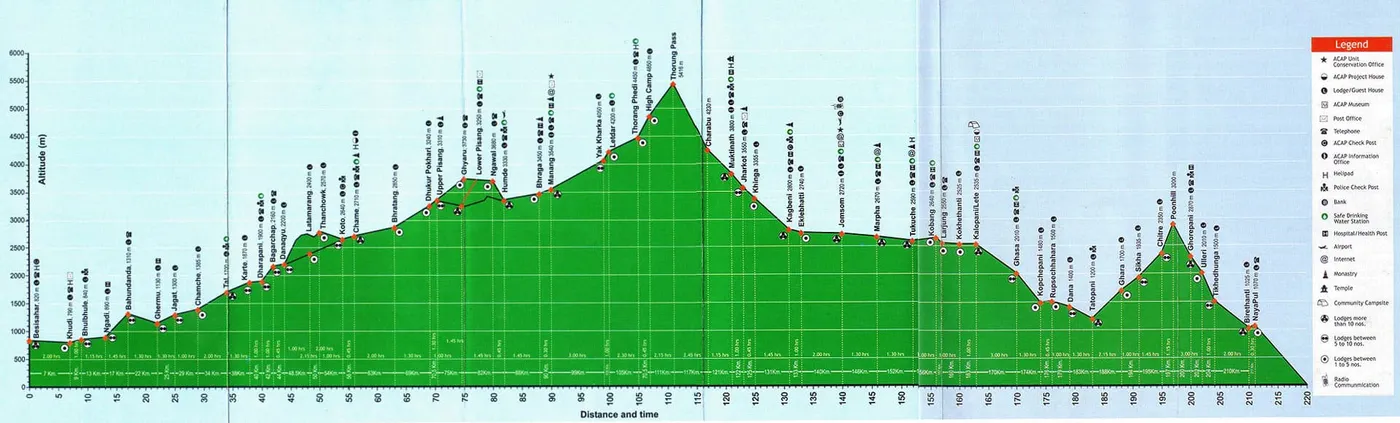
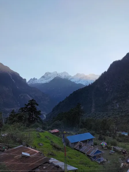
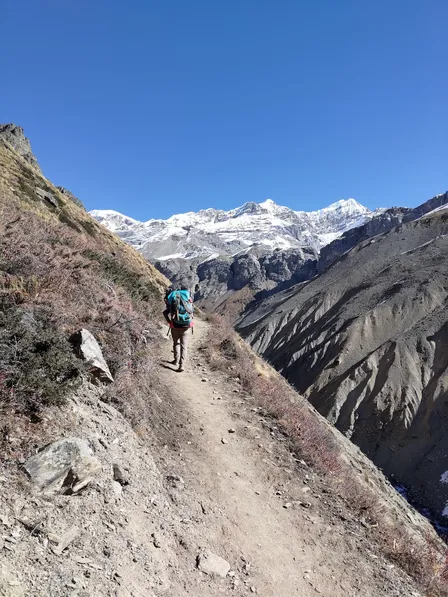
ACT trail starts from Besisahar at 820m altitude. Altitude go up as you go, culminating in Thorung Pass at 5416m. It's this significant altitude changes that you get to experience the various landscapes and ways of life on this trek.
If you don't care about all that, you can take a jeep to Manang. Yes, they built a road for vehicles to reach until Manang(90km in). As a consequence of that, when I walk on the road, vehicles kick up dusts as they pass me by. That sucks and I feel like shit.
However, there are hiking trails that run parallel to the road. Pay attention to them on MAPS.me. I missed many of them. The trails take longer time and involve more ascends and decends, plus some are not well-maintained. So you need to either hire a guide or do your research extensively.
I mostly favored the road because I could experience the landscapes there too. And honestly, I care less the lower altitude landscapes than the snow-capped mountains that emerge ever so slightly as you go. Still, the dusts really sucks! The bandana helped alot there.
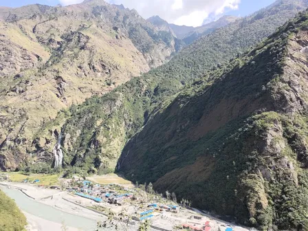
Also, you will be walking along side the Marsyangdi River most of the times. The river supports villages dotted along the main trail. Its sounds is omnipresent giving you a sense of wilderness.
Stuff I Carry
- Tom Bihn Synik 30 backpack
- Klean Kanteen 1.18L water bottle.
- A pair of Bedrock sandals
- 2 wool top base layers
- 2 Uniqlo bottom base layers
- 1 Darn Tough wool socks
- 1 Uniqlo cotton toe-socks
- 1 Uniqlo office pant
- 1 normal hiking pant
- 1 running short
- 2 Uniqlo underwears
- 1 bandana
- 1 fleece sweater
- 1 linen towel
- 1 windbreaker
- 1 long sleeve hiking shirt
- 1 beanie
- 2 cotton t-shirts
- 1 boxer
- Thinkpad T480 laptop
- Kindle Paperwhite
- Some plastic bags
- Some normal tissue papers
- 1 bag of wet tissue
- 1 hand sanitizer
- Passport
- 1 universal power adapter
- 1 Asus Zenfone 8
- 1 toiletry bag
- Medicines for panadol, altitude sickness and food poison
- Water treatment tablets
- 1 Mosquito repellent
All was carried in the one bag weights 9kg. No need for porter. Just carry less shits!
Mistakes
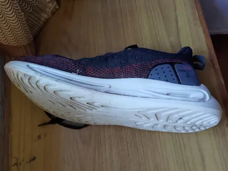
- Get a proper hiking shoes! At least a trail-running shoes. I wore sandal until Manang. On Day-2, the heel of my foots cracked and hurts if I step heel-first, and I had to walk in tip-toe, barefoot-running style from Day-3 onwards while wearing the Darn Tough socks that wasn't a split-toe.
- Seriously, get a pair of shoes! Sandal did feel like a perfect idea in several sections of the road where waterfall was flooding over. Beyond that, I couldn't wait to get to Manang to grab myself shoes.
- My bandana sucks. It's porous and thin. It helps with the dusts. But my lips completely chapped after Thorung Pass.
- A wool split-toes socks would have been nice for the sandal.
- Get a pair of winter gloves. My jacket was just a wind jacket whose pockets did nothing to protect my hands from the chill.
- Get better fleece jacket.
- Get lip gloss!
- Get merino t-shirts
Day 0
I spent the previous week working my day job in a hostel in Thamel. On 21st Oct Friday morning, I took a 10-hours public bus from Gongabu Bus park to Besisahar(0km. This is the default place to start ACT). From there, I took another bus to Bulbule as I'd read the journey in between wouldn't be spectacular. But I ended up in lower Ngadi(10km) like an idiot thinking the bus's final stop was Bulbule.
Mistakes
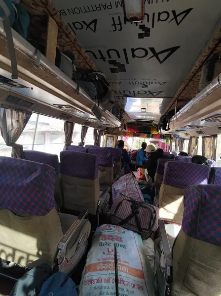
- Don't take public bus! Just pay for jeep or tourist bus that directly take you there. Public bus makes MANY stops and loads and unloads huge bags of stuff along the way. Regardless, the journey is hell. Roads in mountainous area are really bad. Dusty and bumpy pretty much the whole way. Pay for comforts and save time if they don't marginally cost too much for you.
- Shop around for guest house! Ignore owners that hard sell you. When I got off the bus in Ngadi, I was confused about everything. Here comes an owner sees me and pull me to her property. Like an idiot, I follow her. Sure enough, I got ripped off. I paid 2700 Nepali Rupee for a night here(room, dinner and breakfast, and bad drinking water).
- It's at this tea house I realized I didn't bring enough cash for this trek. You need at least 2500NRP per day. My estimate was NRP 600 per day. One dal bhat already cost NRP 600. I'd read from several sources that the next ATM won't be until Jomsom(140km). I panicked about this until Timang(50km).
- But Manang has ATM now!
- Room can be free if you agree to eat their dinner and breakfast. Room rate is negotiable. Apparently dal bhat's prices are standardized.
- Don't drink the tap water at lower altitude. I look for drinking water station with water that's continuously flowing from the tap. I never treated my water.
- Don't bring laptop. I brought it in case I couldn't make it back before my leaves are up.
Day 1
First day of walking! From Ngadi(10km, 890m altitude) to Jagat(25km, 1300m altitude).
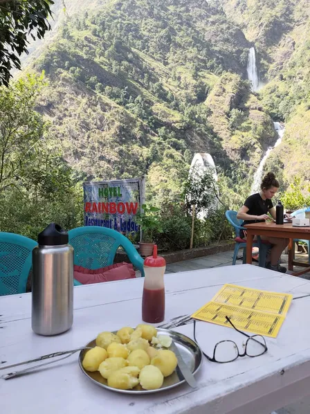
I took the hiking trail to stop by Syange to check out the water falls. They were breathtaking. I'd never seen anything like this before.
Mistakes
- Don't jump on the first guest house you see when entering a village. Walk further in. The view and prices can be better and less crowded too.
- In Jagat, 'North face teahouse' at the far end has a great view.
Day 2
Jagat(25km, 1300m) to Karte(38km, 1870m).
Today I came across several waterfalls flowing over the road down to the Marsyangdi river. They were pretty cool but be careful, particularly one of them had caused a fatal accident.
I skipped Tal which seemed like a recent touristy trap built there to capitalize on the surroundings. The river seems completely reconfigured in the process too.
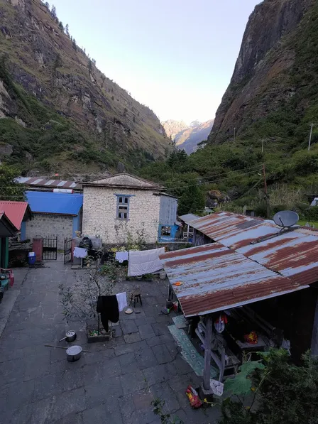
My heels also started to deteriorate here. I originally aimed for Dharapani(40km) but decided to call it at Karte which turned out to be a blessing. It's a very small and quiet village. The owners of the tea house(New World hotel) I stayed at treated me like a family member. The lady owner was amazing - Her Tibetan bread with honey was the first I ever tried and couldn't stop ordering it down the road; She treated my cracked heels with oil; She agreed to exchange a 100USD note I had for Nepali Rupee but I nullified the agreement on last day coz I could tell she was rightfully worried about the authenticity of the note.
It was also on this day that I realized I should skip the villages that most hikers flock to rest for the day. Instead, opt for the smaller villages like Karte. In other words, avoid cookie-cutter hiking itineraries.
Mistakes
- Consider taking the hiking trail although it appeared to come to a dead end after Tal.
Day 3
Karte(38km, 1870m) to Timang(49km, 2615m).
Saved lots of time by taking the hiking trails that cut through the winded road.
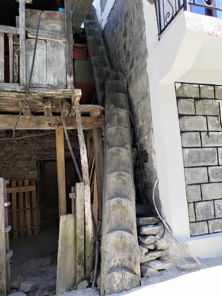
I stopped by Odar. Steep climb. In hindsight, I would skip it. There's a view point with ok view. I read before this village was worth a visit for its medieval atmosphere, but they'd modernized the roof to steel material and things like that. Though, I saw ladders made of tree trunk which was cool - those are the kind of things I want to see.
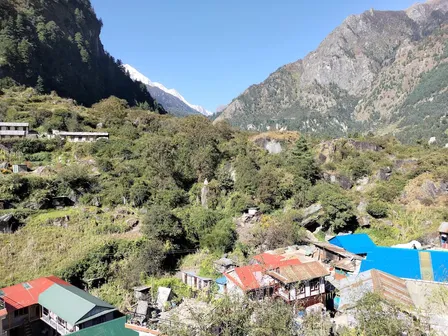
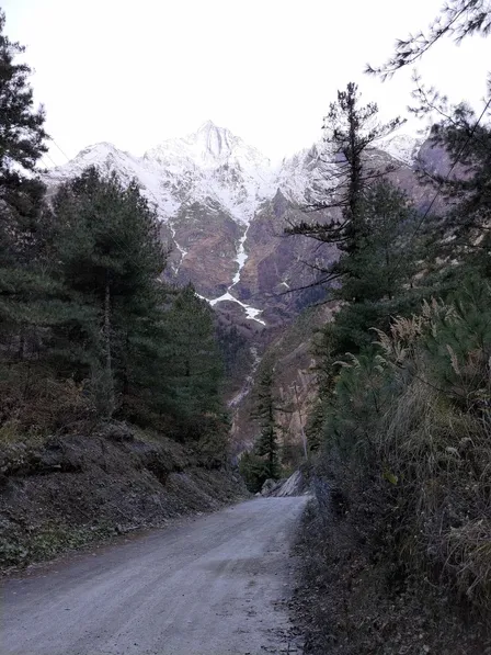
From Timang onwards, snow-capped mountains become very prominent around me. From the tea house I stayed at called 'Prasanna hotel', I could see the Manaslu and Himchuli mountains.
I tried searching on internet if really only Jomsom has the ATM. To my delight, Manang has one too very recently. I was relieved. I start to loosen my belt on foods and teas now.
Mistakes
Today nothing struck me as mistakes!
Day 4
Timang(49km, 2615m) to Dhukur Pokhari(69km, 3240m).
This was a tough journey. Walking on sandal with non-split-toes sock is bothering me. Amazing mountains surround me past Bhratang.
I couldn't make it to Upper Pisang. I stayed the night at Dhukur Pokhari.
Also the night here is freezing and mountains are turning arid and snowy.
Mistakes
- Don't wash clothes and hang them out overnight starting here! They will be frozen the next morning!
Day 5
Dhukur Pokhari(69km, 3240m) to Manang(90km, 3540m).
Turns out Upper Pisang wasn't so far away. This would have been nice place for a overnight: old houses made of earth raw materials on hills; ancient tibetan temple overlooking panoramic view of snowy mountain range opposite; vast yellow-ish grazing fields all surround; yak, chicken, donkeys; a cow desperately finding its way down a steep slope to answer a mating call... - Feels like I have time-traveled to the ancient past at its natural unperturbed state.
I skipped the side trails to Ghyaru and Ngawal to arrive in Manang sooner to sort out my logistical woes - draw much needed cash, get gloves and shoes.
Manang is a big milestone in almost everyone's mind. It's a traditional place to acclimatize for 2 days because past this place, it's non-stop steep altitude gains until Thorung Pass.
I only stayed one night coz I didn't feel anything like altitude sickness the next morning.
Day 6
Manang(90km, 3540m) to Gunsang(96km, 3900m)
Today I put on my new shoes and continue my journey with renewed spirits. I was wrong. My cracked heels are not jiving with the shoes. It hurts every step I take. I also start to feel dizzy and breathless from the altitude. I could only make it to Gunsang which turned out to be a hidden gem!
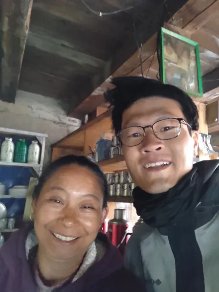
Lots of good memories made at this place. There was only one tea house operational. It's called Chulu West Hotel. It's entirely run by a lady(with a man from Manang working the potato fields and walk back once he finishes). It was inspiring to watch her work. After I told her about my predicament with my heels, she prepared me a bucket of warm water plus salt to sooth and hopefully heal my cracked heels. That's when I decided I will heal and acclimatize for few nights here.
Another most amazing thing about this place is the perfect breath taking panorama of Annapurna Himal right next to the tea house - And I got the perfect room for it.
I stayed two nights here. The first night I stayed all by myself because the lady owner had to be in Manang and carry some stocks back up by herself the next morning. The night was eerily lonely, quiet only to be interspersed by strong winds whistling against my window. It was dark, cold, with nothing but me, mountains, creatures, and the stars. I also experienced the altitude headache and breathlessness for the first time.
I was relieved when the day breaks. I remember sitting on a bench on the roof marveling at the himal while anticipating the lady's return. I saw her slowly making her way around the mountains from afar. I knew things were going to be ok soon.
On my second day here, it's busy in the kitchen. Many hikers would stop by for tea. I helped her out where I can in the kitchen mainly watch the fire to prepare hot water and wash the dishes. At one point, she offered me foods(a plate of boiled potatoes and half of an extra spring roll). I felt I was part of her operation now.
I spent the second night with the lady owner, a hiker couple, a Nepali researcher and his partner passing by as part of their study about snow leopard in this region. Also, my heels had healed alot and altitude sickness had subsided.
I can't recommend enough to stay in this tea house.
Mistakes
- Didn't know there weren't Wi-Fi service beyond Manang until Muktinath since two years ago. Also power charging and hot shower are hard to come by. I stopped showering here.
- NCell mobile coverage sucks beyond Manang. Look into 'Ntc'.
Day 8
Gunsang(96km, 3900m) to Ledar(100km, 4200m).
I figured this would be a good altitude increment. Remember to listen to your body. General rule is not more than 500m climb per day.
Day 9
Ledar(100km, 4200m) to High Camp(107km, 4850m).
I saw power lines getting setup on this stretch. I didn't like the sight of them.
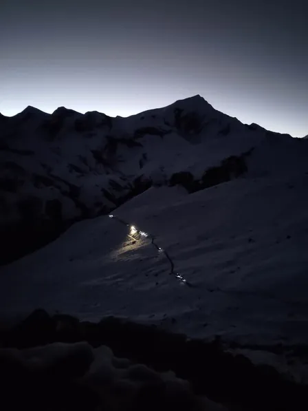
High Camp(or Thorung Phedi) is the last stop where people rest before making the push to Thorung Pass at around 4 - 5am next morning.
Steep and slow climb here. I constantly catch for breaths after few steps due to the altitude.
I shared a dorm with 2 seasoned solo travellers. Couldn't fall asleep here. Altitude headache got to me big time.
Mistakes
- Get a pair of sunglasses. Combination of snow and sun will fuck up your eyes.
- Get a headlamp! You will regret not having one when going to toilet at night and the ground is icy.
Day 10
High Camp(107km, 4850m) - Thorung Pass(111km, 5416m) - Muktinath(121km, 3800m) - Taxi to Kagbeni.
High Camp comes to life at 4am with people waking up, coming out of their room with backpack, heading to kitchen for breakfast, and hiking guides busy sorting out things for their client.
Now, Thorung Pass is completely covered with snows. The trail is snowy, icy, rocky, slippery. Before the trip, I saw a snowy photo with clear flat dirt path outlining the trail, and somehow that'd dominated my entire notion of this place. I couldn't be more wrong. Since I didn't have a headlamp, initially I held my phone to light the way. I'm glad I did - the path in the very beginning was abit dodgy with steep slope on the other side. But then I stopped because my hand was freezing(gloves from Manang sucks) and I wanted to save battery since I heard today was by far the longest day on ACT. So I started walk closely behind someone with lights. Even then, I barely could see the path. This whole time I was super alert to not make a wrong step and got myself into trouble.
Needless to say, I was relieved when the dawn breaks.
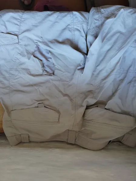
Coming down from Thorung Pass, I realized I didn't have another thing most people had: crampon!

The surface of most parts of this trail was frozen probably due to friction heat from foot traffic. So without crampon, I keep slipping left and right. I had to scootch down and push myself to avoid slipping over to the slope on other side or sliding down the trail adjoined by multiple slopes and risk hitting my foot and butt into the rocks underneath; I had to step few feets to the side of trail that's still snow and constantly bang my toes on the rocks underneath; intentional and accidental butt slide, and ended up destroying my hiking pant and slightly got my wrists cut when trying to brake and maneuver. My journey here progresses at a snail rate while others with crampon breezely walk past me. I start to worry if it's going to be like this for much further before it gets dark and even more chilly. What if I come to a cliff and my silly maneuvers won't cut it? Others can't borrow me theirs. I would need a helicopter rescue that costs a fortune.
Luckily, the snowy part of the mountain ends at some point. The trail becomes a dirt path. I was relieved - again. I'm exhausted. But it is over. I changed back to my sandal to relieve my blistered and banged up toes, and continued my way to Muktinath in relative comforts.
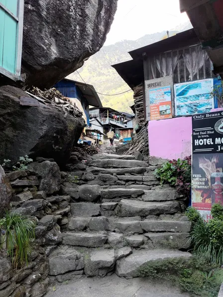
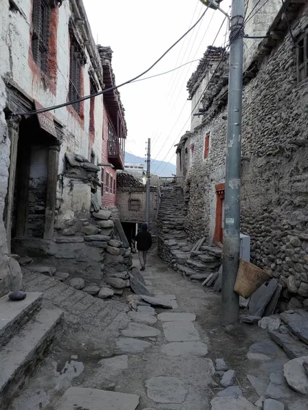
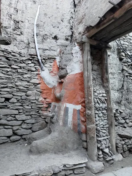
Then I took a taxi to Kagbeni village and spent a night there. Kagbeni is amazing - Medieval, tibetan, fresh apple juice, food, mystical.
Mistakes
- Get headlamp!
- Get crampon! And maybe hiking poles.
Last words
I know I could have prepared myself for everything this trek could possibly have up its sleeve. But wouldn't that deprive me of all surprises and serendipities? Because if I did, I would have missed out on unique experiences like those I had in quaint villages such as Karte and Gunsang.
My approach to this trek was to both research and pack the bare minimum, then go out there and listen to my body and wisdom of the local people - and comport accordingly to the reality. When the natives - who have stayed there for generations - say this tap water is safe to drink, their words should weigh more than what you might have gathered from the internet. Up to the point I cracked my heels, I'd asked several locals whether my sandals were enough. All of them said I need shoes. Still, I was adamant. It took me few villages of wisdom and unignoreable pain to accept I was wrong. I wasn't listening as much and sincerely as I thought I would.
Similar to how microplastic has tainted our blood stream, from peak of Mount Everest to bottom of Mariana Trench, we carry the responsible ethos with us to the mountains as well. We see the mountains as a beast. We tame them with technologies: Water treatment technologies are deployed, branded high-tech gears stomped the grounds leaving clouds of dust in its wake, and on High Camp, portable solar panel charger was used to charge our mobiles. We leave no wiggle room for uncertainties and discomfort, when in fact, they can be catalyst for groundedness and growth.
Honed and domesticated by the logics of global industrial civilization, hiking has become a mission, a conquest - to be performed efficiently in order to fulfill personal agenda. And once that's accomplished, we happily return to the bosom of the state and grease its wheels that will continue to deface the mountains where we just came back from.
I wonder: Am I really there for the mountains and to listen and learn, or just to check something off my bucket list? ☘